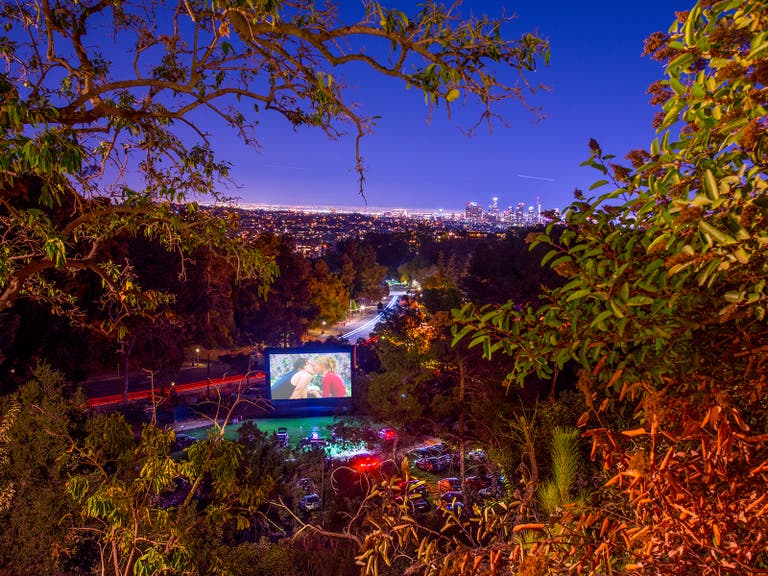
Step Up to the Best Intermediate Hikes in Los Angeles
One of the best aspects of living in LA is outdoor access. The beach, mountains and desert are all within striking distance. Hiking is always an option, whether it’s the Santa Monica Mountains, Griffith Park or the mighty San Gabriel Mountains. We previously covered the Top 10 Easy Hikes in LA. Now you'll learn about eight of the best intermediate hikes in LA County that will yield prized views and get your heart pumping, but won’t require a day off from work to recover.
1. Carry your cell phone with you in case of emergency. The signal can be limited in the mountains, but in case you run into trouble, the phone is your best friend.
2. Carry plenty of water because trails often have little shade and it can get hot.
3. Wear sunscreen and a hat. Even if the sky starts out overcast, sun often breaks through clouds.
4. Stay to the center of the trail to limit contact with plants like poison ivy and wildlife like rattlesnakes and tarantulas.
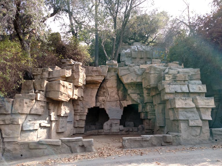
Bee Rock (Old Zoo Hike)
Distance: 4.0 miles
Route: Loop
Park in the Griffith Park Merry-Go-Round lot. Take the road you drove in on past the white barricades. Before you reach more barricades, take a left on the third fire road. Take an immediate right at the fork and gradually climb a fire road that overlooks Wilson Golf Course and the distant Verdugo Mountains. Pass through an open fence to a paved road, with animal enclosures on your right and cages to your left - the remnants of the original L.A. Zoo. Take a left on the paved road. Walk left through a gaping hole in a fence. Climb to a fork in a dirt road and take a right. Look up and you'll see a fenced-in lookout at the top of Bee Rock, your final destination. Descend the trail and once you reach a road that dead ends at a fence, take a hard left - a rock face on your left guides you higher. Take a right at the fork and pass through brush on a single-track. Navigate rocks and logs and duck tree branches. Dig in your toes on the climb to a road. Take a left and look for a garbage can. Take the stairs down a rocky, graffiti-lined path to the rusted fence lookout, which overlooks the golf course and Valley. Retrace your steps and take a quick right down a single-track dirt path. It can be slippery, so stutter-step. Descend the switchbacks. Take a right at a fire road. At the fence, take a right. A gradual climb along a high fire road eventually reveals the merry-go-round. Take a final left back to the parking lot.
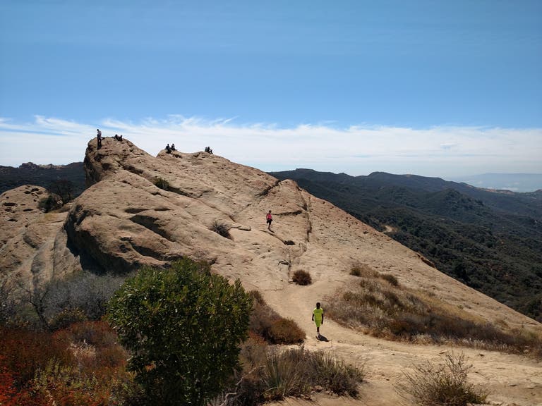
Eagle Rock Hike
Distance: 5.4 miles
Route: Out And Back
Start at the Trippet Ranch parking lot, which costs $10 for the day. Pass horse stables, picnic tables and what looks like the ranger’s house to reach the paved Musch Trail. Start your traverse with dry grasses on each side of the trail. Take a right on the single-track Musch Trail towards Musch Camp. Cross a small bridge and continue down a winding trail. Switchbacks climb the hillside, revealing more views of Santa Monica Mountains in the distance and the widening valley below. Musch Meadow Trail leads past a campsite, which you’ll see on your right. Continue through a tan meadow and bear right on Eagle Junction. Wrap past chaparral and sagebrush to reach a fire road. Take a left on the fire road and you’ll wrap around the hill. Once you see two garbage cans and an EAGLE ROCK sign, take a right. Climb the massive Eagle Rock. Comfortable with heights? The views get better further up the rock. Double back down the fire road and take a right at the parking sign to reach the lot.
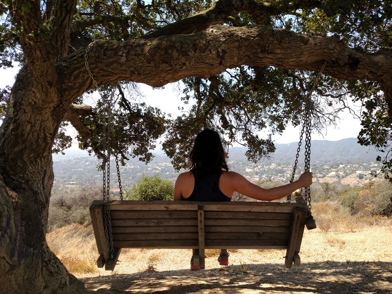
Kenter Canyon Hike
Distance: 4.2 miles
Route: Out And Back
North of Sunset Boulevard, Bundy Drive becomes Kenter Avenue and your route to a terrific hike. Start in Crestwood Hills, an architecturally controlled Brentwood community with Mid-Century homes. Climb down and up a windy paved path. Take a left on a dirt fire road and follow the power lines north, with canyons on either side. Eventually, you'll see the end of Mandeville Canyon below on your left, including a private compound with a pond and tennis courts. Continue to climb the fire road that wraps around a hill. Stay with the low road when given a choice, unless you prefer higher resistance. Either way, you'll arrive at the same destination: Mountain Gate Estates. Pass through the high-end neighborhood to continue on Upper Canyonback Trail. Otherwise, turn around. This time, take each right fork in the road on your descent. On the third hilltop, you’ll find a tiny bench and even better, a swing under a shade tree. Continue back to your car.
Rivas Canyon Trail
Distance: 4.2 miles
Route: Out And Back
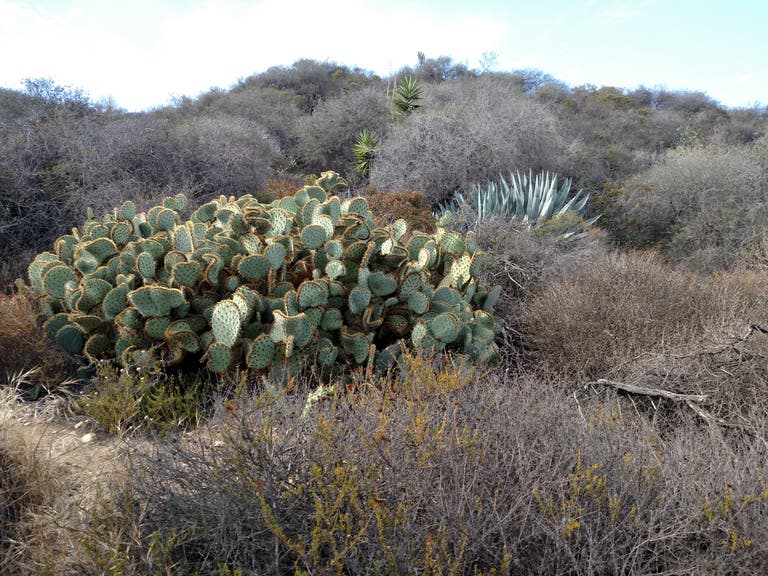
Start just past the guard gate to Will Rogers State Historic Park. Find the trailhead on your left. Concrete quickly gives way to a dirt single-track and chaparral. Pass through an open field and gate, then descend a horseshoe-covered trail into Rivas Canyon. Cross a cul-de-sac and continue into the trees. A healthy canopy helps ensure you won't roast on this hike. At the 1.1-mile mark, climb up the hill at a SMMNRA Hiking Trail sign. Switchbacks offer views of the next mountain ridge. Pass ferns and level off with cacti and views of Pacific Palisades. You may even encounter some pale yellow hollyhock stalks, which rise from the brush. Plentiful trail markers keep you on the straight and narrow until the finale. At an unmarked fork, take a left and climb down to Gateway Park and Temescal Canyon before retracing your steps.
Rustic Canyon to Murphy Ranch Park
Distance: 3.3 miles or more
Route: Loop
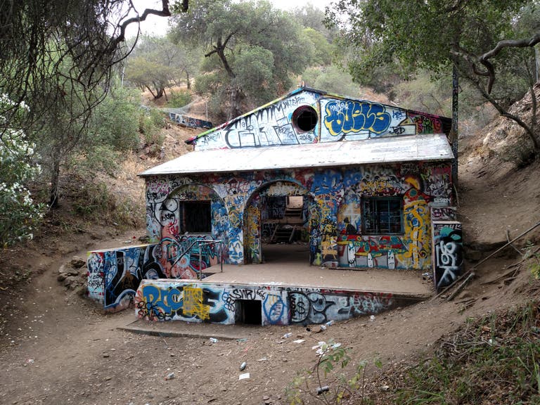
Capri Drive climbs above Sunset Boulevard into a ritzy part of Pacific Palisades. Reach the end of the road and take a left on Casale Road. Wrap around and reach a yellow gate. Pass through the gate and continue on a graffiti-lined road with the occasional hollyhock. A green ridge is visible in the distance to your left, a rock face to your right. Take the stairs through a hole in the fence. Descend 529 stairs and be rewarded with a dirt path lined with pines. Pass through the graffiti-covered, fenced-off remains of Murphy Ranch, an encampment that Nazi sympathizers constructed during World War II. After exploring, climb the stairs up to a paved road. Take a left. At the fork in the road, take a hard right and pass a water tower to reach a stone-framed gate. Pass through a hole in the stone to get back to the main paved road. Take a left to pile on the miles and reach more trailheads, or a summer camp called Camp Josepho. Take a right to reach the beginning of your hike.
Temescal Canyon Hike
Distance: 3.65 miles
Route: Loop
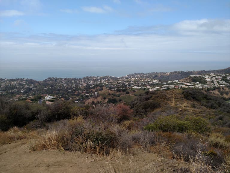
Another good Pacific Palisades hike. Park in the lot by Sunset Boulevard, which costs $7 per car, or find street parking. Walk north down a paved road, past picnic areas and the Temescal Canyon Conference & Retreat Center. Follow a Do Not Enter sign on the left. Take a fork to the left and go up dirt stairs. Almost immediately, you’re presented with three options. Take the center trail up a hill, climbing switchbacks past cacti and brush. Pass under a canopy of trees and continue to climb to the top of a ridge. A right arrow at the 1-mile mark points you down the hill, then dips right back up. Take a right at the fork on Temescal Ridge trail. Wrap up the hill to reach a clearing and lookout of the Pacific Ocean and high-end homes. Continue up and stay to the right. Head downhill. The landscape gets greener and shadier. Cross a small bridge and descend with the canyon on your right. Coast straight down a flat fire road and pass a cabin compound with chirping birds, back to the parking lot. Bonus: there are pristine bathrooms at the base, which is not a given in area parks.
Victory Trailhead
Distance: 5.1 miles
Route: Loop
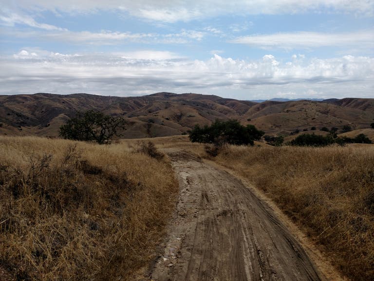
Take Victory Boulevard to its western end, past high-end residences, to a $3 gravel parking lot. Pass through a turnstile into Upper Las Virgenes Canyon. Descend a dirt fire road, with rolling hills all around you. Take a right at the first fork in the road and continue west. The trail bears left, but continue straight instead to the steady hum of grasshoppers. At the 2.2-mile mark, bear left down a single track trail. Take a left on a fire road. Climb up to the ridge, with mountains rising behind you. A wide trail opens before you. Take a left on a fire road, wrap along the ridge-top. Bear left at a fork and find mountains on your left, a field to your right. Take a left at the fork, and then another left at the fork on Joe Behar Trail. Enjoy a straightaway on the fire road. Bear left at an oncoming hill. Take a right and you’ll overlook luxury homes. Take a final right and return to the parking lot.
Zuma Canyon Trail Ocean View
Distance: 3.1 miles
Route: Loop
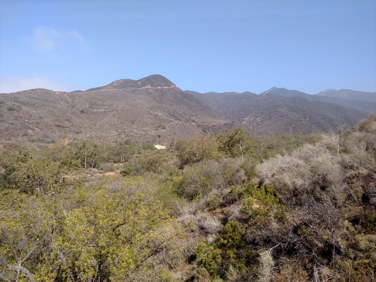
Park in a dirt lot at the end of Bonsall Drive. Walk to the end of the lot and begin an initially flat walk through the canyon. At your first fork, bear right to start up Zuma Canyon Ocean View Trail. Even though this is only a mile from Pacific Coast Highway, the trail feels desolate, with chaparral, lizards and a gradual, moderately steep climb. At the top of the trail you’ll have views of PCH below and the Pacific Ocean in the distance. Take a left, followed by a left at a fork in the road. The trail levels out, and after passing a sheer rock face, one of the only shady points on your route, you begin the descent down a dusty trail, with clear views of high green mountains in the distance and more trails tracking high overhead. Stay to the left on your way down and return to the original parking lot.
