Top 10 Best Running Trails in Los Angeles
The best places to run in LA from Griffith Park to the South Bay
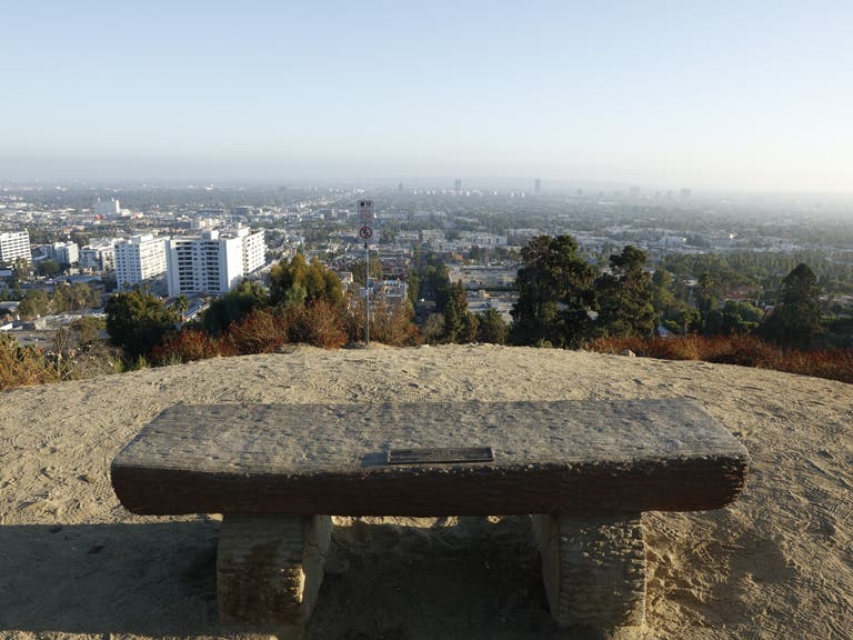
With its gorgeous weather and breathtaking scenery, Los Angeles offers countless running paths for health-conscious locals and visitors to get their hearts pumping. There are always excellent running trails nearby, from the heart of LA to the spectacular coastal views of the Beach Cities, here are some of the best running paths in Los Angeles.
Mount Hollywood - Griffith Park
Spanning more than 4,200 acres, Griffith Park is one of the largest municipal parks in the U.S. and one of the largest urban parks in North America. Some of LA’s most popular attractions are located within Griffith Park, including the Los Angeles Zoo, the Griffith Observatory, the Autry National Center, and the Greek Theatre. There are numerous Griffith Park running trails , including Griffith Park Drive from the Los Feliz Boulevard/Riverside Drive entrance; Crystal Springs Drive in Park Center to the Zoo; and Zoo Drive to the Travel Town Museum. Griffith Park also boasts a 53-mile network of hiking trails, fire roads and bridle paths.
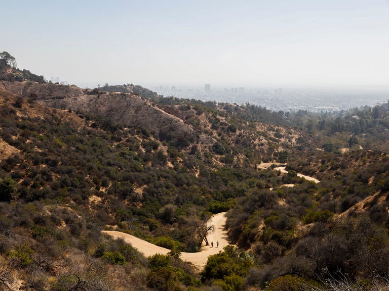
For a memorable off-road run, take the trail that leads from the Observatory parking lot to the summit of Mount Hollywood, the highest peak of the park, which rewards you with spectacular views of the entire Los Angeles Basin.
West Loop - Elysian Park
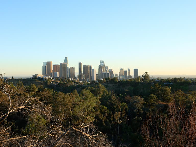
At 600 acres, Elysian Park is the second-largest park in LA. It's also the oldest park in the city, founded in 1886. During the 1932 Summer Olympics, Elysian Park hosted the shooting portion of the modern pentathlon events. The West Loop at Elysian Park hike offers scenic views of Downtown LA and the San Fernando Valley. The trailhead for the 2.4-mile loop is located at Elysian Park Drive and Stadium Way. Most visitors park in the lot at Chavez Ravine, a short distance from the trailhead. The West Loop is an easy, dog-friendly trail that offers good shade and several offshoot paths for exploring the area further.
Inspiration Point & Clouds Rest - Runyon Canyon
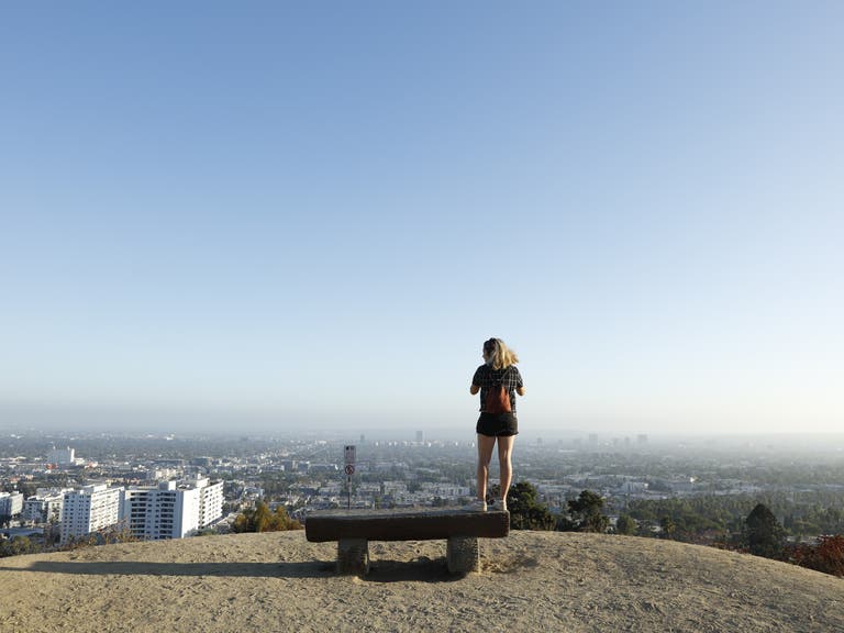
Hollywood joggers love Runyon Canyon Park is a 130-acre park located just two blocks from world-famous Hollywood Boulevard, west of the Hollywood Freeway (US 101) extending north to Mulholland Drive. The park is well known for its frequent celebrity sightings and a 90-acre off-leash dog park. From the Fuller Avenue entrance at the bottom of the canyon, you can jog on the trail clockwise or counter-clockwise. Going clockwise involves a gradual run up the back of the canyon, heading around the east ridge to Clouds Rest and then coming down the steep slope and steps to Inspiration Point, before taking the fire road back down to the entrance. Going counter-clockwise is a hardcore climb up the steps and steep slopes between Inspiration Point and Clouds Rest, before the gentle slope back down one of the best runs in Los Angeles. Whichever route you choose, your run includes breathtaking panoramic views of Los Angeles - on clear days, you can see all the way to Catalina Island.
Drake Stadium - UCLA
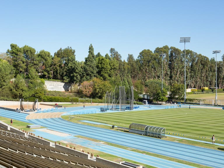
Drake Stadium is the home of the UCLA Bruins soccer and track & field teams. Located on the northwest end of campus, Drake Stadium is named in honor of Elvin C. "Ducky" Drake, a legendary UCLA student-athlete, track coach and athletic trainer for over 60 years. Marshall Field - the grass infield that’s widely considered one of the finest playing surfaces in the country - is named for UCLA alumnus and Oscar-nominated film producer, Frank Marshall. Thanks to its Tartan track surface, the nine-lane, 400-meter track is perfect for a run any time of year - four laps is about equal to a mile. World-class athletes like Blake Leeper are often training at Drake Stadium.
For a serious cardio workout, hit the stadium stairs for a variety of exercise routines. Because of frequent team practices and sporting events, check the UCLA website for track availability.
Lake Balboa
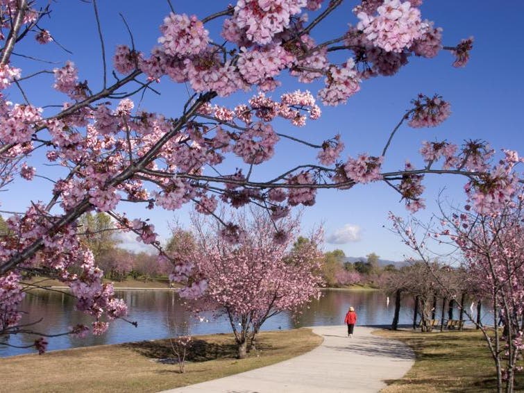
Anthony C. Beilenson Park is an 80-acre recreation facility located in the Sepulveda Basin of the San Fernando Valley. The 27-acre Lake Balboa is the park’s centerpiece, filled with water from the Tillman Water Reclamation Plant, site of the renowned Japanese Garden. Besides a 1.3-mile mile running path, the park features barbecue pits, a bike path, children's play area, fly fishing area, pedal boats, picnic areas, and private boating. During the blooming season (roughly February to March), the lake’s 2,000 cherry blossom trees offer a stunning backdrop, whether you’re jogging, strolling or enjoying a picnic.
San Vicente Boulevard - Brentwood
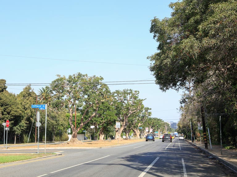
The grassy median along San Vicente Boulevard is one of the Westside’s most popular running paths. The median begins at Federal Avenue, just east of Suzanne Goin's acclaimed Tavern restaurant, and heads west for four miles through the Brentwood community before it terminates at Ocean Avenue. When the median is at its widest, a dozen runners or more can run side-by-side - you’ll often see local track teams on practice runs. Looping the median offers an eight-mile run that includes luxury homes and spectacular coastal views. The coral trees along the median were planted in the 1940s after the Red Line trolley tracks were removed - they've since been declared a Los Angeles Historic-Cultural Monument. The final leg of the famed “Stadium to the Sea” course of the LA Marathon enters Santa Monica at San Vicente Boulevard and 26th Street, and continues west to Ocean Avenue, then south to the finish line at Ocean and California Avenue.
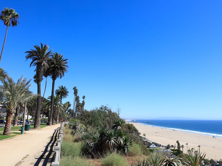
Palisades Park
The 26.4-acre Palisades Park is located along Ocean Avenue, offering breathtaking panoramic views of Santa Monica Bay from atop the sandstone bluffs. The park stretches 1.5 miles from Adelaide Drive to the historic Santa Monica Pier. The three-mile loop includes 30 varieties of plants and trees, sculptures, cannons, and a unique landmark, the 19th-century Camera Obscura.
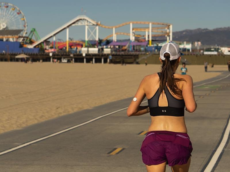
The Strand - Santa Monica Pier
Formally known as the Marvin Braude Bike Trail, the Strand is a 22-mile paved bike path that begins at Will Rogers State Park in the Pacific Palisades, and ends at Torrance County Beach in the South Bay. The Strand Santa Monica run has pedestrian walkways adjacent to the path - be sure to stay within the designated areas and be aware of bicyclists when they tell you “on your left” or “passing right.” For a more vigorous workout, head closer to the water for a hearty run on the sand. The two-mile run between the Santa Monica Pier and the Venice Boardwalk takes you to some of the most well-known sports destinations in Los Angeles, including Muscle Beach, the famed outdoor basketball courts, and Venice Skatepark.
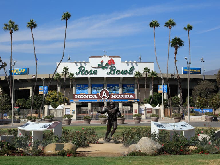
Rose Bowl Loop
The Arroyo Seco in Pasadena offers more than 22 miles of trails for hiking, biking, and horseback riding. The Arroyo Seco offers a variety of experiences, from paved to unpaved paths, and flat to steep grades. The Rose Bowl Loop is the most popular trail in the Arroyo Seco, offering walkers, joggers, and cyclists a great place to exercise with spectacular views of the Central Arroyo. The Rose Bowl Loop is about three miles long and circles the world-famous Rose Bowl Stadium and the fairways of Brookside Golf Course. The route is distinguished by colored pavement - striping and delineators help separate pedestrians from cyclists and motorists.
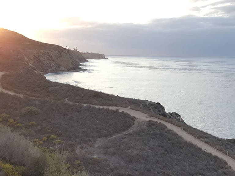
Ocean Trails Reserve
The Ocean Trails Reserve, located in the Palos Verdes Peninsula, offers more than five miles of scenic runs with varying degrees of difficulty. From the parking lot at the end of La Rotonda Drive, take the paved road to the trailhead. There are numerous trails to explore, including the Catalina Trail, Coastal Switchback, and Sagebrush Walk, along with breathtaking views and tidal pools by the beach.
